An unknown majestic view deep in the outback of Tokyo
Tokyo is no doubt an urban metropolis but amazingly abundant in nature an hour away from its center, notably Mt. Takao.
If you venture farther west in Okutama area, richer nature awaits you.
Nature abounds in Oume City and Okutama Machi, etc. but let’s focus this time on the Kanotoiwa Rock in Hinohara Mura.
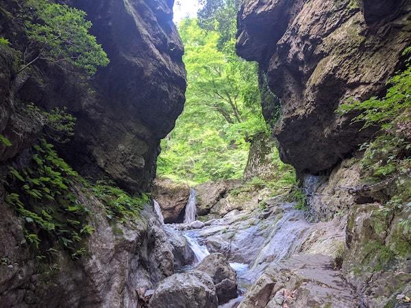
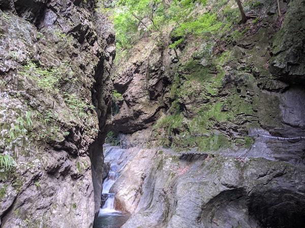
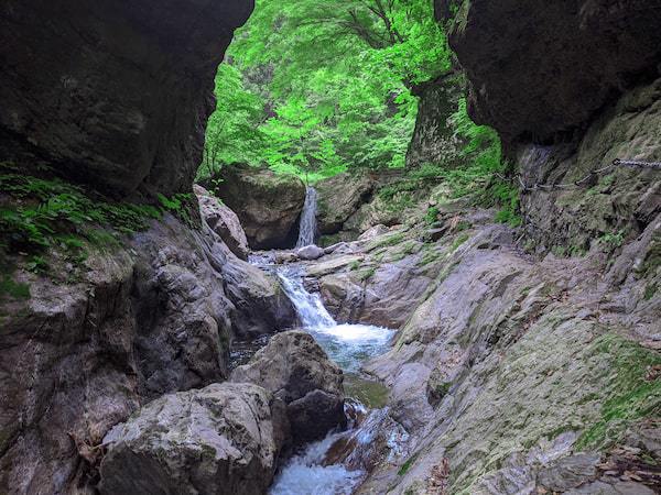
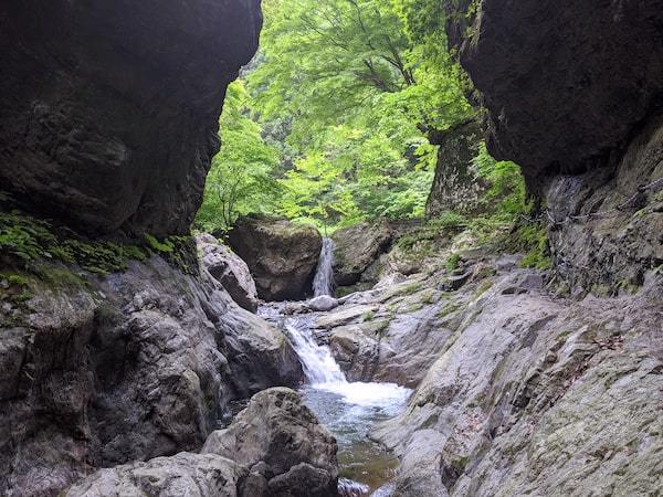
Look at this mystic scenery – a waterfall beyond the cleavage of the colossal rock.
This rock is called the Kanotoiwa, named, as it literally means, the God’s Road.
We suggest you drive your way to the Kanotoiwa
Because, the pubic transports are inconvenient and time-consuming.
A fixed-route bus for Fujikura (Nishi Tokyo Bus) links Musashi Itsukaichi Station (terminal of JR Itsukaichi Line) and Kanotoiwa Iriguchi (bus stop) in 30 minutes.
The bus runs only once an hour or less often.
You get off at Kanotoiwa Iriguchi.
The rock is inconveniently located, a good 30-minitute walk away from the bus stop.
So, your option should best be driving your way.
By car, you get on the Chuo Freeway at Hachioji Junction and switch to the ground road at Akiruno IC.
It takes not more than 2 hours from central Tokyo.
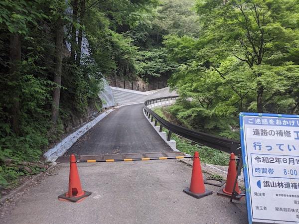
As you drive through the Kanoto Camping Ground, the road gets so narrow that you might wonder if you could ever pull through.
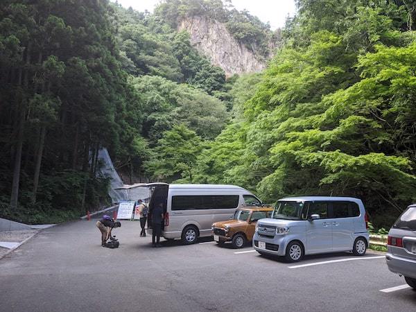
No worry, there is a well-furnished parking space beyond.
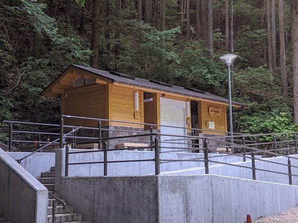
Right beside the parking lot is a modern toilet – spic and span all around effective, June 2020,
so it must have been installed only recently.
Get off your car and on you go to sight the topical rock!
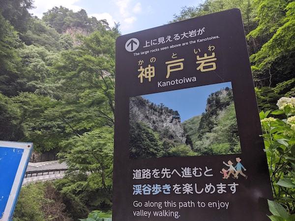
Beyond the info board by the parking lot is the Kanotoiwa.
A flat pathway from the parking lot to the entrance.
From the parking lot to the entrance leads a smooth, paved pathway easy to walk on.
The pylon ahead of you is a car stop, so don’t bother to stop yourself.
On you right beyond you’ll see a brook.
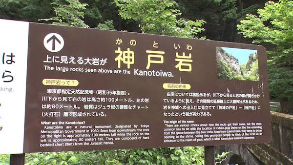
Some 200 meters farther, there stands an info board with data on the Kantoiwa.
It says how the rock ever came about, how it got to shape up as it does, etc.
The Kantoiwa is actually one piece of hard rock
The rock is said to be from the chert (flint) stratum of the Jurassic Period.
It looks like two huge rocks rising face to face but is once piece of enormous size.
It has run over by water for ages, the mid-section dug into a deep groove to make it look like two rocks facing each other.
It’s hard to see, but the right-hand side is 100 meters high and the left 80 meters.
The route is divided into two options, right and left; we recommend the left route which is a bit harder to path.
Those who have hard time walking or happen to wear heeled shoes are recommended to take the right route.
(Farther info is due later.)
The approach to the rock is like mountaineering!?
You take the narrow pathway on the left-side of the info board.
The area is heavily bushed with grasses in the summertime.
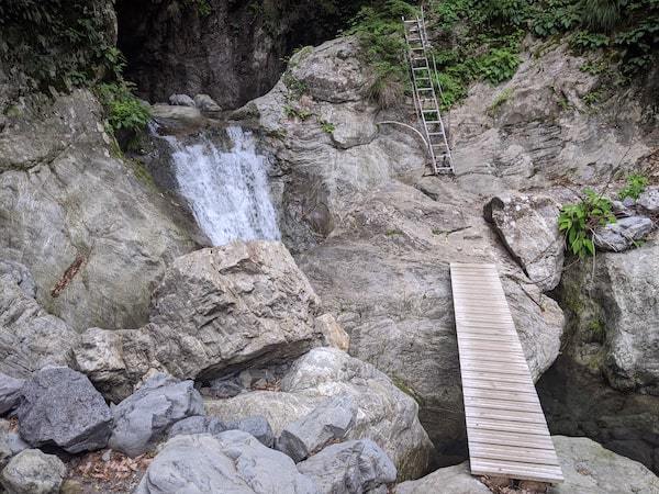
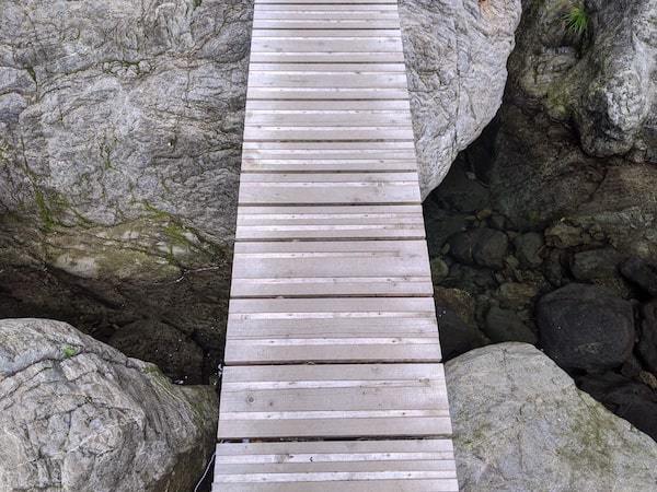
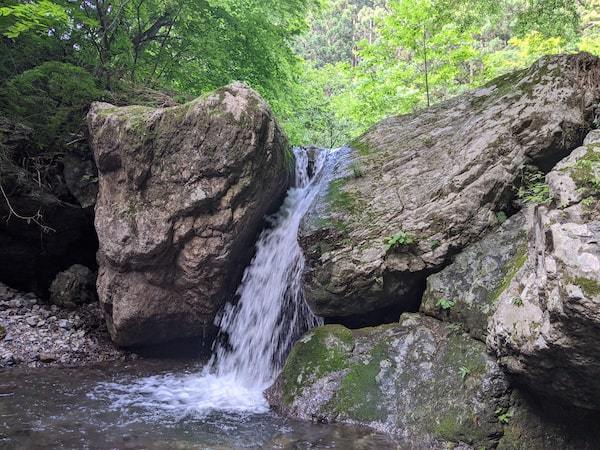
Don’t bother the bush and walk on. In a matter of 5 meters or so, you come to a bridge 40 cm wide and beyond a waterfall with fall of 4 meters.
As you come this far, it gets cool in midsummer – thanks to the fall.
That means it might be rather chilly around here if you come in the season of autumnal tints.
You cross this bridge and walk on.
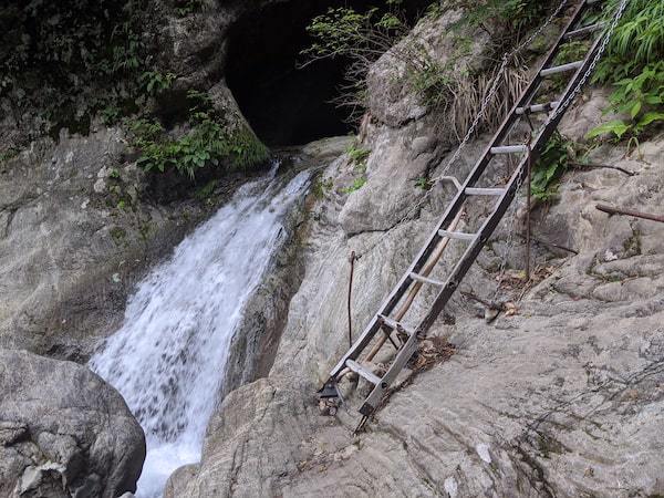
Can you spot a ladder deep in that photo up there?
You are going to climb that ladder.
The bridge itself is not built so high that it shouldn’t scare you, BUT the problem is that ladder.
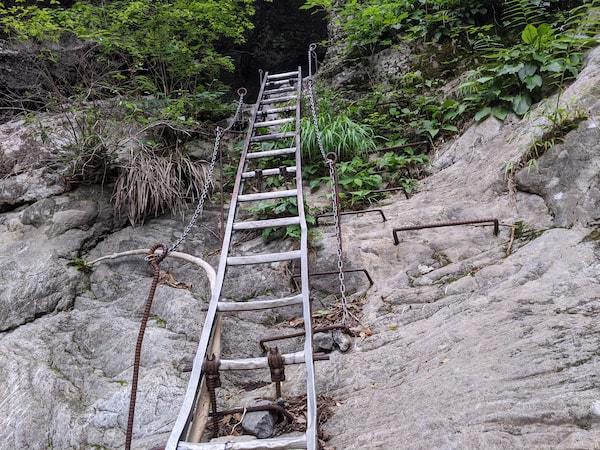
It looks like the one you would find built along the trail.
About 3 meters long and a chain is laid along with it.
You wouldn’t use such a chain when climbing a ladder, would you?
It reminds you of the chain handrail in mountain climbing – so scary!
By the way, the Kanotoiwa is so popular that not a few people repeat visiting.
If you bump into someone by the ladder, remember the rule: descent has the right of way,
So, if this someone happens to be a “downer”, let him or her pass by.
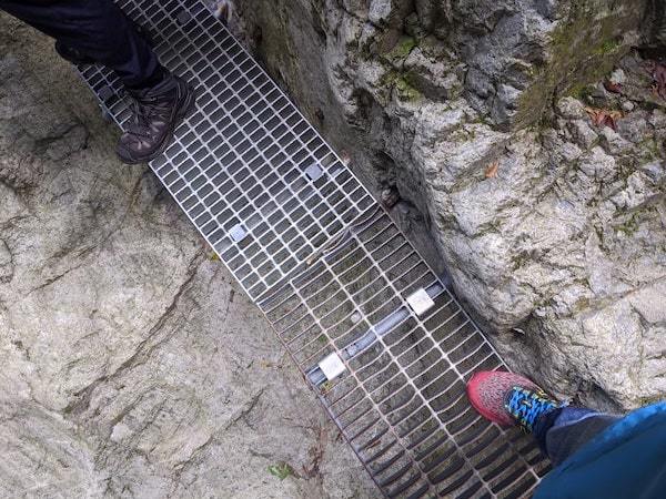
Climb the ladder, and you’ll see a narrow pathway beyond.
Narrow pathways stretch on forward – routes about 30cm wide and 200m long, net-barbed, shaved out of rocks, etc.
The above photo shows the way the chain stretches on, right to left toward farther away.
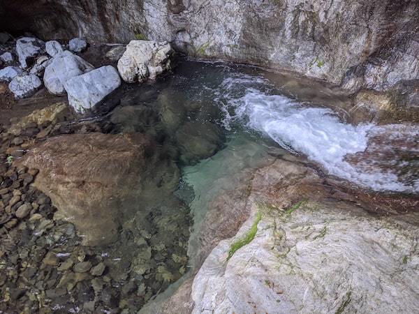
On the left-hand side is a cliff about 2 meters high; there’s a brook below and you had better watch out lest you should slip and fall.
The water is transparent and utterly clean.
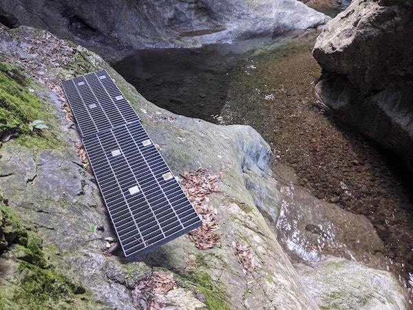
This is the photo of a foothold farther forward, taken as I turned around looking back.
The pathway is rocky but not so rugged as mountain trail; it stretches on only for 200 meters or so.
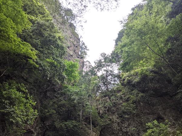
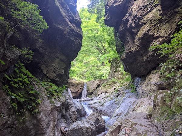
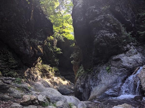
When you come to notice rocks rising face to face,
that is the point where you can view the notorious scenery from which the Kantoiwa was given its name.
Don’t come too close to the waterfall beyond the rocks if you don’t want to miss the total vision of the Kanotoiwa with an waterfall in between.
The Kanotoiwa is the door to the God’s Road
The extended line linking the slit between the rocks and the waterfall points to the Oodake Shrine.
The God enshrined there walks the road, hence the Kanotoiwa, the God’s Road.
Two high-rising colossal rocks and a fine slit of air drawn in between; a waterfall seen through the slit against the background of green-leaved trees.
It’s a thrilling sight so rich in vitality.
This scenery does have something mystic that makes one believe this really is the God’s Road.
Hold your camera at a low angle, position the waterfall in the center between the rocks,
and take a look at what you get hold of – there you see an impressive sight of a waterfall cut out by the rocks as an ideal frame.
A magnificent sight created by Mother Nature!
The spot should look swell buried in the greens in the summertime; it must be great in the fall with autumnal tints.
Incidentally, you have limited space for photo-taking and mostly rather narrow and unstable.
You should be careful in the presence of others.
There might not be enough space even to set up your tripod.
If you are a photo craze, you ought to be there either early in the morning when light is abundant or else late afternoon.
Now that you’ve come all the way to visit the spot, you do well by passing through the rocks to get to the waterfall.
The waterfall is about 3 meters high.
It offers you a luxurious moment to enjoy breathing air amid a broad, open space.
This is how it looks from the waterfall back to the route you have come by thus far.
After a moment of relaxation by the waterfall, you are to return to the parking space and that presents a headache –
that is, returning the narrow pathway away from the waterfall intercrossing with others walking up toward the waterfall is quite a problem.
There is another route to approach the waterfall, and you are recommended to take that route on your way back.
The return path is behind the waterfall
The easy way back is a stairway on the right-hand side of the waterfall.
You are to ascend the stairway.
After that, you are to walk on for about 20 meters to get to a paved road.
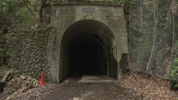
There is a tunnel on your right; you are to walk through the tunnel for 100 meters or so and walk a while more to get the info board by the entrance.
The tunnel route is flat and easily accessible by those with trouble walking or with heeled shoes.
Remember, though, such rugged pathways are part of your fan viewing the great sight of the Kanotoiwa.
Then, by all means, choose right foot wares to challenge your ambitious tour.
This way you can avoid intercrossing with up-coming visitors on the narrow pathways.
You are definitely to take this tunnel route.
This is the entrance of the tunnel route as seen from the info board.
The tunnel is not lighted within; so, try lighting your way with your cellphone light.
The route mildly curves on the way; there are spots sunlight coming from the entrance wouldn’t reach.
Just for your info, this tunnel is otherwise known as a famous Ghost spot.
Well, there is nothing to it after all…Don’t let that worry you.
After all, you are viewing this gorgeous sight called the God’s Road.
So, there it is.
Here is a yet unknown spot of gorgeous sight within the Tokyo metropolis: the Kanotoiwa, the God’s Road!
Be adventurous and visit the God’s Road just once.
 JAPAN Travel Concierge